Addresses in Brandenburg (Germany) in OpenStreetMap
This project compares the official address data (house numbers) of the state of Brandenburg in Germany with the addresses mapped in OpenStreetMap. It highlights the addresses that might still be missing in OpenStreetMap.
Preview
Background info
The basic geo data of the state of Brandenburg (in Germany) are available as Open Data under the license “Data licence Germany – attribution – version 2.0 dl/de/by-2.0”. This includes the Georeferenced Addresses (house number coordinates). Since April 2020 it is possible to use this data in OpenStreetMap.
Using the data in JOSM
This project provides the Georeferenced Addresses as background layer for the OpenStreetMap editor JOSM. The official addresses are compared to the ones on OpenStreetMap. Those addresses that might be missing in OpenStreetMap are highlighted.
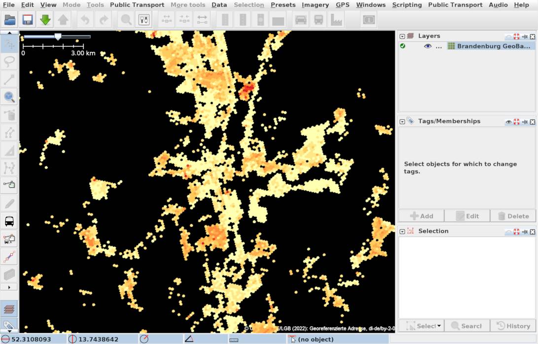
Overview on low zoom level
On low zoom levels you get an overview where addresses might be missing in OpenStreetMap: Red colors mean that more addresses could not be matched.
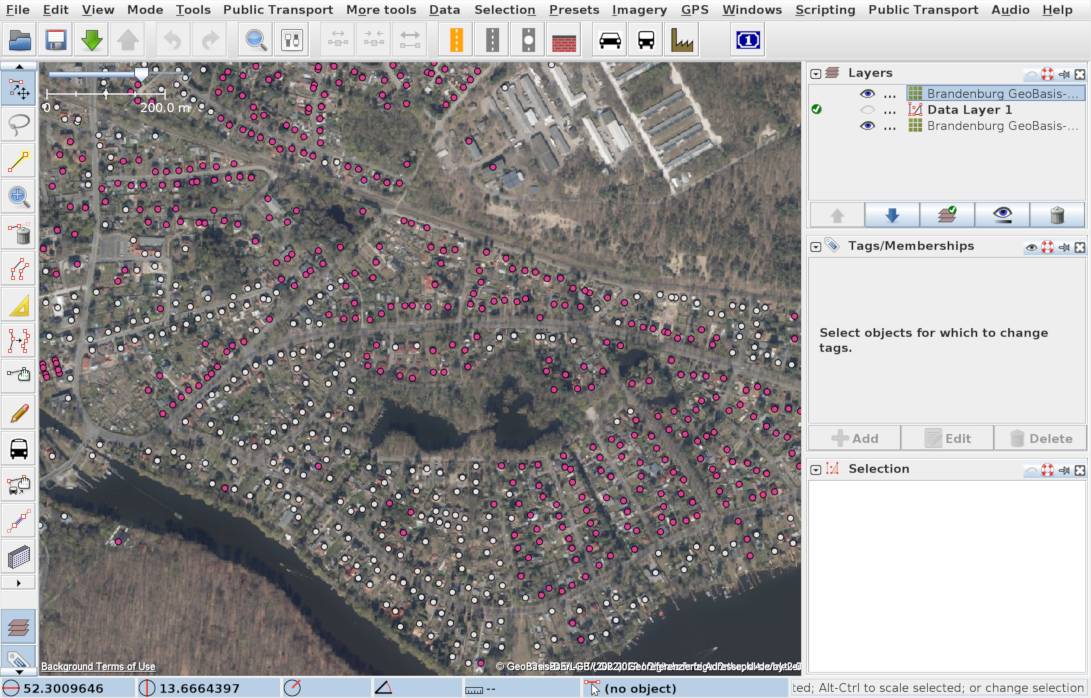
Single addresses as points
If you zoom in a little, the single addresses are drawn as points and colored: white = match, pink = no match, blue = match, but more than 75 m apart.
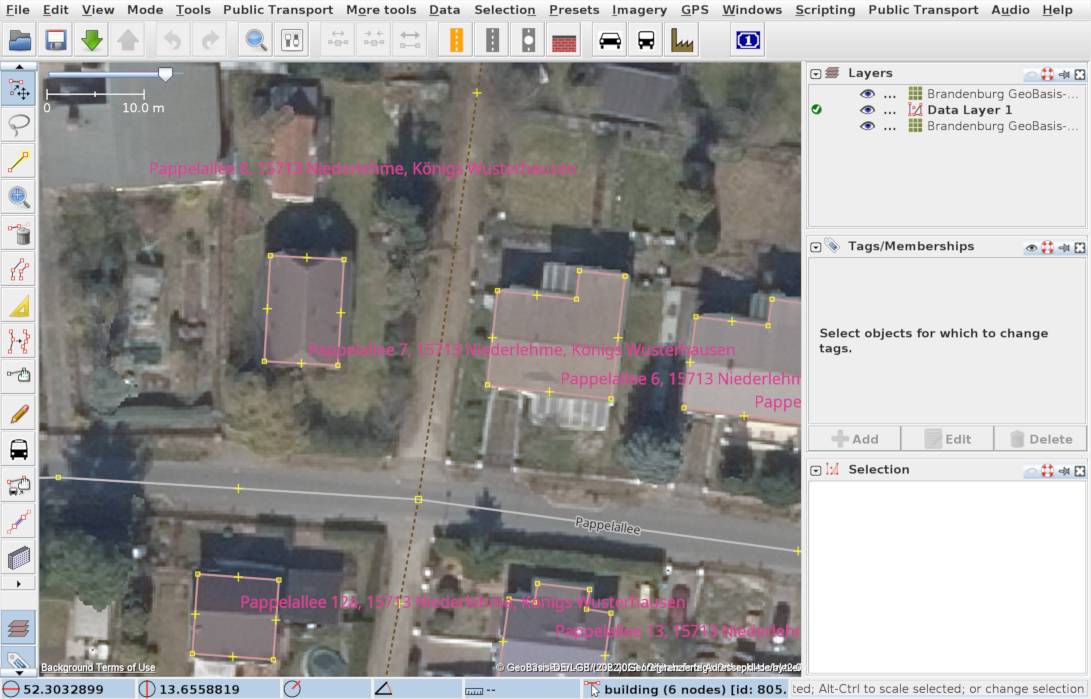
House numbers
If zoom the map to the level of single houses, the house numbers are shown. In this view it’s easy to add house numbers if it’s clear which street they belong to.
Complete Addresses
If you zoom in even further, the complete addresses including street, postal code, municipal district and municipality are shown. This is helpful to get this data directly, or if it’s not clear which street the number belongs to.
Use with MapWithAI
An alternative method for advanced mappers is to use the data with MapWithAI